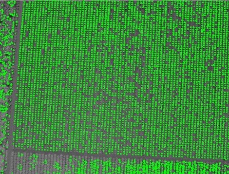
Tree Detection and Related Applications in Forestry
Using aerial images taken by drone, plane or satellite, RSIP Vision can create forestry image processing and analysis software to efficiently determine: Trees detection Automatic
Using aerial images taken by drone, plane or satellite, RSIP Vision can create forestry image processing and analysis software to efficiently determine: Trees detection Automatic
RSIP Vision creates forestry image processing and analysis software by using aerial images taken by drone, plane or satellite. Our algorithms enable to efficiently determine:
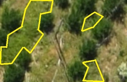
Using aerial images taken by drone, plane or satellite, RSIP Vision develops software for image processing and analysis in forestry to efficiently determine: Forest border